


Projects Last Projects
CHANGE DETECTION IN REMOTE SENSING SATALITE IMAGES USING DEEP LEARNING
Ayelet Alon, Inbal Tziperman Lotan and Tal Amir
Supervised by Alex Golts
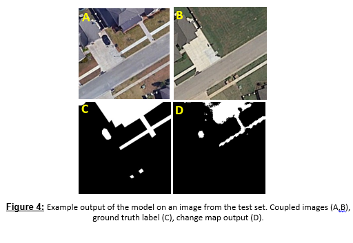
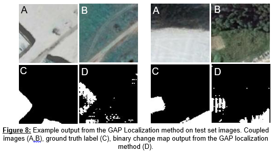
Change detection in remote sensing images is an important part of many applications such as tracking urban changes for military purposes, tracking deforestation for climate change research, agricultural monitoring and more. We pose the change detection task as to identify differences between two photos, taken at the same geographical location at two different times. The detected changes should be a result of appearance of new or disappearance of existent objects in a scene. The images may contain other differences between them that are a result of many factors such as seasonal changes (snow, trees with/ without leaves), changes in brightness, shifted images due to slight changes in the capture angle and many more. Tracking changes manually is a tedious task and can be highly time consuming. In addition, since the task is extremely tedious, doing it manually often results in human errors. The automation of this task is therefore highly desirable. In this project, we present an automation of the change detection task using both a fully and weakly supervised semantic segmentation based neural network. We compared the performance of our model to a previously published GAN based model, and showed that though our model is easier to train it achieves similar results.

Please, see project report.
Please, see final presentation.